

Compare five urban fishing options in Toronto, North Vancouver, Calgary and Montréal, with official access checks, local restrictions and practical trip plans.
- Five named waters across four city regions
- Separate access permission from fishing rules
- Check the bank, advisories and return journey
Bottom line Choose the water and permitted shore before packing a presentation.
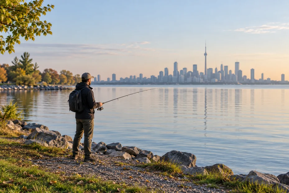
Updated 28 October 2026.
The best urban fishing spots in Canada depend on your city, available time and permitted shoreline. Toronto Islands and Grenadier Pond, North Vancouver’s Rice Lake, Calgary’s Bow River and Montréal’s Lachine Canal offer five different starting points. Each needs its own access and fishing-rule check.
For a first outing, choose a manageable shore session. A park pond, a large river and a navigable canal put different demands on your casting space, tackle and attention. A city name on a fishing list does not tell you which side of a fence, lock or protected shoreline you may use.
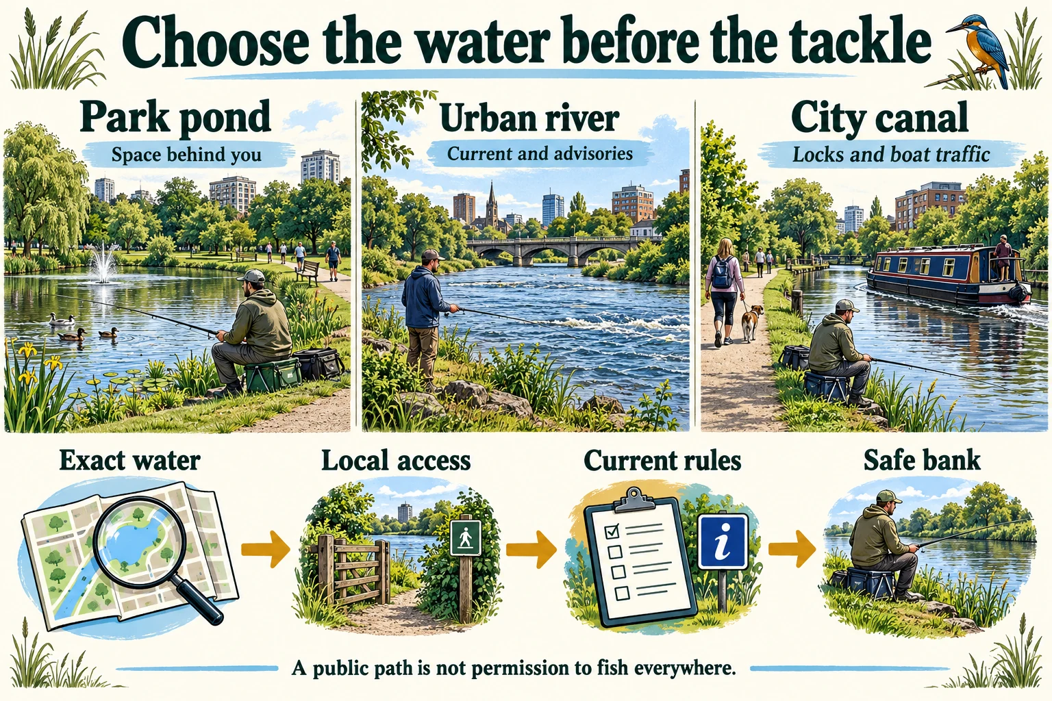
Open the full-size urban fishing explainer
Best urban fishing spots in Canada: compare the outing
Choose the outing before choosing a lure. These five options cover four metropolitan regions, from park ponds to a large river and a working canal.
| Water and city region | Choose it for | Check before leaving |
|---|---|---|
| Toronto Islands, Ontario | A shore-fishing outing combined with a park visit. | Operating ferry route, return sailing and rules for the exact water. |
| Grenadier Pond, Toronto | A pond visit with a defined permitted shoreline. | City fishing-area map and Ontario species/date rules. |
| Rice Lake, North Vancouver, B.C. | A forested freshwater-lake outing with a fishing dock. | Reserve notices, walking approach, dock needs and Region 2 rules. |
| Bow River, Calgary, Alberta | A moving-water session with room to learn river presentations. | Exact reach, bait restriction, retention limits and current advisories. |
| Lachine Canal, Montréal, Quebec | A canal-side outing reached on foot, by bicycle or transit. | Lock and bridge exclusions, Quebec water rules and boat traffic. |
A fishing dock described as accessible does not establish that every approach, washroom or transport connection meets your needs. Check the whole trip with the site operator if step-free access or a particular bank height is essential.
Locate the city region before the actual fishing bank
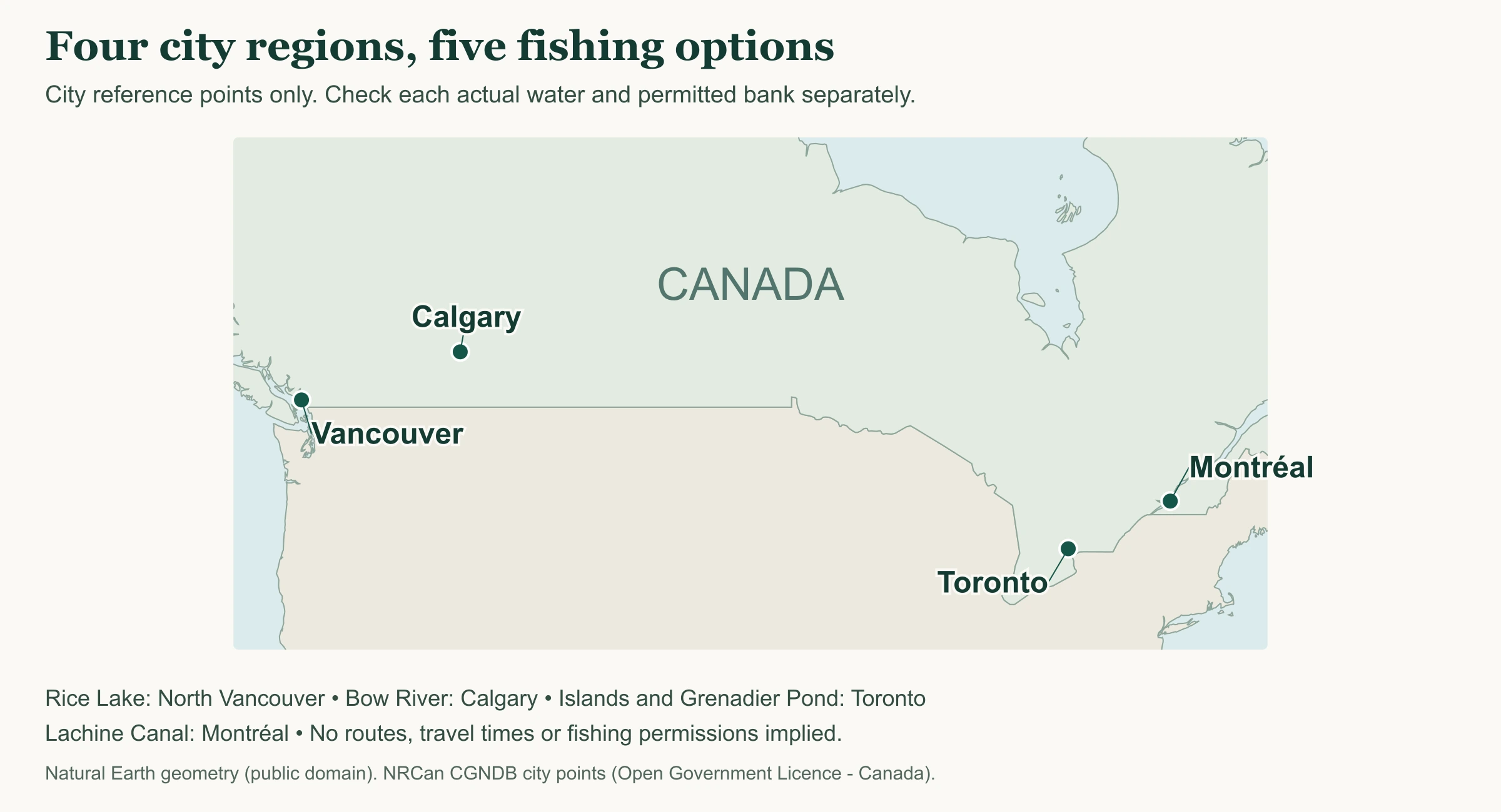
Open the full-size city orientation map
Choose the named water next, then find its official access information. This map does not mark a launch, an accessible fishing position, an open shoreline or a public-transport route.
Map: CanadaFever. Geometry: Natural Earth, public domain. City coordinates: Natural Resources Canada, CGNDB. Contains information licensed under the Open Government Licence – Canada. Original map created 28 October 2026.
Toronto: an island outing or a designated pond shore
Toronto Islands: plan the journey back first
The City lists fishing at Toronto Island Park subject to Ontario fishing rules. That makes the islands a useful option when you have enough time for the crossing and a walk, rather than only a short gap between other commitments.
City ferries depart from Jack Layton Ferry Terminal at 9 Queens Quay West. Check the current operating route and timetable for both directions. The City’s published winter arrangement uses Ward’s Island; do not assume a summer Centre Island sailing operates on your date.
Review the specific water and on-site signs before choosing a bank. An island visit can involve different shore exposures and shared park spaces. Keep a covered rod and enclosed tackle while travelling, and leave enough time to pack away hooks before walking back to the dock.
A calm channel and a windy lake-facing bank should not share the same plan. If wind, waves or boat movements make the edge unsuitable, use the park visit as the day’s activity. The cost and effort of a ferry crossing do not make a marginal bank worth using.
Grenadier Pond: follow the designated shoreline
High Park’s current City page identifies a permitted fishing section from the Maple Leaf Garden towards the entrance at The Queensway and Colborne Lodge Drive. Follow the linked permitted-area information and signs; the path around the pond does not open its entire shoreline to angling.
The City also describes TTC access, including the seasonal 203 High Park bus and the 506 Carlton streetcar. Check the operating service and the walk from your chosen entrance. Reaching High Park is a different task from reaching the designated fishing shore.
Grenadier Pond can suit a short casting-practice session from a permitted park position, with clear space behind and beside you. If walkers, children or waterbirds occupy the space your line would cross, keep the hook packed until the area is clear or choose another lawful position.
- Use the official park map to distinguish a pedestrian route from the fishing area.
- Keep bags and rods out of the walking route; move the whole setup if you cannot share the space.
- Choose a lure you can retrieve without repeatedly snagging shoreline vegetation.
Western city options: Rice Lake and the Bow River
Rice Lake, North Vancouver: freshwater beyond the city core
Rice Lake is in the Lower Seymour Conservation Reserve on the North Shore. The Freshwater Fisheries Society of B.C. describes shore fishing, a fishing dock at the lake’s southern end and rainbow-trout stocking. Stocking history is no promise that a particular visit will produce a catch.
The Society identifies the Rice Lake Gate on Lillooet Road as an approach, with a walk to the lake. Use Metro Vancouver’s reserve map to understand the gate, trails, wharf and facilities, then check current reserve notices. Do not transfer a map’s wheelchair symbol into a guarantee about every part of the journey.
If travelling without a car, plan the public-transport connection and the remaining approach separately. A stop near the North Shore trail network may still leave a substantial walk with tackle. Check the current transit planner rather than using an old route number from a fishing report.
Use the province’s freshwater regulations page for the Lower Mainland synopsis and subsequent changes. Rice Lake is a freshwater choice. Advice for tidal Vancouver Harbour or salmon fishing on another river cannot supply its licence, method or catch rules.
Bow River, Calgary: check the main channel and reach
Calgary’s river-access information identifies sites such as Shouldice, Edworthy and Carburn as orientation points in the river corridor. These are access references, not declarations that every adjacent bank is open to fishing or suitable for standing.
The 2026 Alberta guide lists the Bow reach from Banff National Park downstream to Bassano Dam, including the reservoir, with a bait ban and a zero-trout limit. Read the row for the exact reach, the provincial conditions and any later notices. Do not extend that row into Banff National Park or into a tributary.
A nearby boundary can change the answer: the Inglewood Bird Sanctuary entry closes its waters except the Bow’s main channel. Being beside the same river does not make a sanctuary channel interchangeable with the mainstem.
Check Alberta angling advisories and the City’s river notices before approaching the bank. A pathway can remain useful for walking while high water, erosion or poor footing makes an angling position unsuitable. Start from stable shore and use the river fishing guide for wider planning; this shortlist does not assess whether you can safely wade a particular flow.
Lachine Canal, Montréal: fishing beside a working waterway
Parks Canada identifies the Lachine Canal as an urban fishing option reached by public transport or the cycling path. It lists species including common carp, rock bass, pumpkinseed, northern pike, black crappie and yellow perch. Their presence does not mean each species is open to targeting on your date.
The site’s current activity instructions prohibit fishing within 10 metres of a lock or approach wall and on bridges spanning the canal. Choose a bank outside those exclusions and observe the posted instructions. A convenient railing or bridge is not an alternative fishing platform.
Follow Quebec’s current licence requirements and the rules for the named canal water. The provincial licence page explains the general licence requirement, exceptions and identification requirements. A national historic site should not automatically be treated as a national-park fishing-permit destination.
Keep the path clear and manage the line when boats pass. Carry a small setup that can be packed quickly if the bank becomes crowded. Before casting, consider how you would retrieve the lure and handle a fish without climbing down a wall or obstructing passing visitors.
A worked rule check for Grenadier Pond
For a proposed Grenadier Pond visit, separate the City’s permitted fishing area from Ontario’s rules about fishing. Use the official shoreline map for the fishing boundary. This original diagram separates the two rule checks.
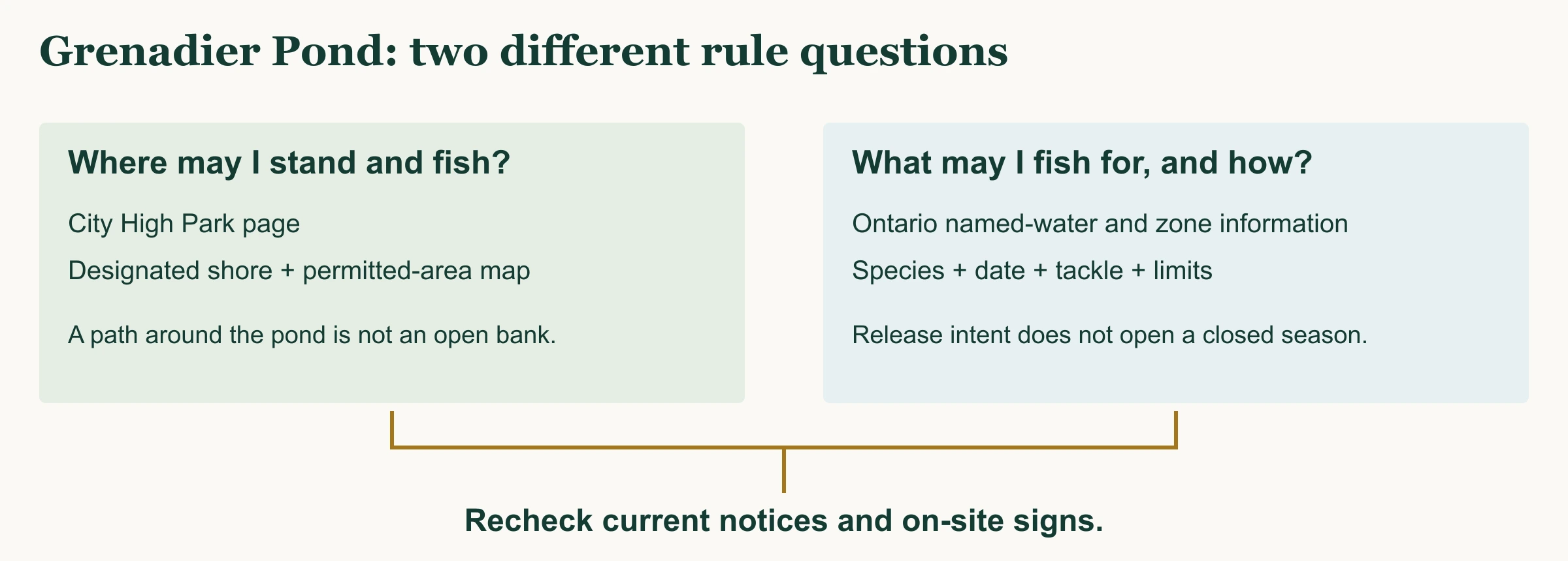
Open the full-size Grenadier Pond lookup
| Question | Official starting point | What it does not establish |
|---|---|---|
| Which shore is designated? | City High Park fishing section and the permitted-area map. | A species season, provincial licence exemption or consumption allowance. |
| What may I target on this date? | Ontario fishing information: locate the exact pond and applicable zone, then check species and exceptions. | Permission to fish from a restricted part of the park. |
| Can I use the position today? | Current park notices and signs at the actual bank. | A guarantee of safe footing, space to cast or a catch. |
Ontario’s season guidance says a closed species cannot be targeted even if you plan to release it. Write the proposed target and date in your notes before packing. If you cannot resolve the named-water or boundary question, ask the relevant authority before fishing.
Plan a short session you can finish comfortably
Before you leave: three practical steps
- Choose the named water, a permitted fishing area and a target species. Check the licence, date, tackle and retention rules through the appropriate authority.
- Check transport, site notices, weather and the return journey. Select a shore position only after seeing the bank and the other people or wildlife using it.
- Pack for that one presentation, including hook-handling tools and a way to carry every offcut home. Keep enough time to pack before your transport or access window ends.
For a freshwater licensing and regional overview, use freshwater fishing in Canada. If a trip changes to national-park water, check the separate national-park fishing guide before carrying over a provincial setup.
Pack light enough to manage the whole bank
A modest spinning setup can suit many shore sessions, but lure weight, line and terminal tackle still need to fit the target and the water. Use the fishing techniques learning paths to select a presentation you can control. Bringing a second rod does not create room for a second line.
- Keep hooks and lures enclosed during a bus, train or ferry journey. Carry the rod so it cannot catch another person or overhead fittings.
- Bring suitable hook-removal tools, line cutters and a secure container for offcuts. Deal with loose line before it becomes a hazard to birds.
- Carry accepted licence and identity documents separately from your personal notes. A notebook is a reminder, not proof of permission.
- Plan fish handling from the actual bank height. If the position would require an unsafe reach or climbing onto structures, choose another permitted position.
Two practical items for a compact city kit
Use the box and notebook you already own if they meet these needs. These examples help organise a limited tackle selection and keep the access plan together. As an Amazon Associate, CanadaFever earns from qualifying purchases.

Plano ProLatch StowAway 3600, model 2360001
Sort the small selection you intend to use before leaving home. The listing title says “White”; the pictured box and manufacturer specification describe a transparent body.
- Six to 21 adjustable compartments for separating small tackle.
- Transparent body and ProLatch closures; check the packed box fits your bag.
- Listed dimensions of 11 × 7.25 × 1.75 inches; no waterproof protection is claimed here.

Rite in the Rain No. 935, green 3 × 5-inch notebook
Keep the water name, access notes and return connection together, with the date of the rules you checked.
- Green cover, top-spiral binding and Universal page pattern.
- Three-by-five-inch sheets; the manufacturer specifies 100 pages, or 50 sheets.
- Use a pencil or compatible writing tool for wet notes; it does not replace official documents.
Check the selected model, seller terms and Canadian delivery before purchasing.
Leave useful notes and a clean shore
- Record the position and method you actually used, plus anything that prevented you from fishing.
- Keep snagged line and hooks contained. Never pull a line across a path or towards another person.
- Clean and dry equipment before another waterbody, following local biosecurity requirements.
Urban fishing questions
Do I need a licence for urban fishing in Canada?
Check the jurisdiction for the exact water and your eligibility. Age, residency and other exemptions differ. A city park location does not itself create an exemption; tidal, freshwater and national-park requirements are not interchangeable.
Which of the best urban fishing spots in Canada can I reach without a car?
High Park has City-described TTC connections, Toronto Islands have City ferry service, and Parks Canada identifies public transport and cycling access for Lachine Canal. Check the current service and the walking approach to the permitted bank. Rice Lake needs separate planning for its North Shore approach.
Can I fish anywhere along Grenadier Pond?
No. Use the designated shoreline shown in the City’s fishing information and map, then check Ontario rules for the intended species and date. A walking path around the pond is not permission to fish its entire edge.
Can I keep a trout from the Bow River in Calgary?
The cited 2026 guide lists a zero-trout limit for the Bow reach from Banff National Park downstream to Bassano Dam, including the reservoir. Recheck the exact reach, current notices and other requirements. Rules inside the national park and on tributaries need separate checks.
Does catch and release make a closed season irrelevant?
No. Ontario explicitly prohibits targeting a species during its closed season even if you do not keep it. Check the corresponding rules wherever you fish. Access permission, a lawful target and a permitted method all need to match the outing.
Official planning links for the next visit
Access and regulation examples were checked on 28 October 2026. Recheck site notices, provincial rules and transport operations for the date of your outing.